Drone technology captures river changes
Charlotte Milne graduated with a first-class MSc at the beginning of 2020.

“I have loved nature and rivers since I was a kid. I was three years old when I asked my grandmother ‘how did the hills get there?’ and by the time I was five I was telling everyone I was going to be a geographer when I grew up.
"I specialised in rivers because they are perhaps the most intriguing feature in New Zealand’s dynamic landscape. Not only are rivers complex and beautiful, but they also have a deep importance in our culture.
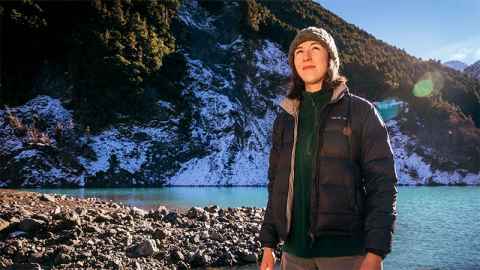
“While the 2016 Kaikoura earthquake was devastating, it created unique opportunities for new and exciting studies. My research was based in the Hapuku River, a large gravel river just outside Kaikoura township. Following the earthquake, a landslide dam formed at the top of the river and created a lake that posed a flood risk.
“Over a few years, the lake drained and the dam started to release pulses of course sediment downstream. As a result, the riverbed levels increased significantly. My research was focussed on assessing how the gravel sizes, organisation and riverbed levels changed over time to get a sense of how the pulse material would change the river’s sedimentology.
I urge new researchers in the field of environmental science to pick study
areas that fascinate them and questions that they are desperate to answer. Then your postgraduate research will become an amazing opportunity to fully submerge yourself in something that you love.
“I enjoyed being based at such an exciting and relevant field site, surrounded by other stimulating projects. I used state-of-the-art, high-resolution drone technology and Structure from motion (SfM) modelling to assess the alterations. Understanding the sedimentology of my study site will help predict future adjustments in the river and inform management practices for geomorphic, habitat and hazard purposes in Kaikoura.
“In the field in Kaikoura I flew drones, taking photographs and collecting information on the river’s sediment. I accessed remote sections of the river by helicopter, and viewed the river from its source in the Kaikoura ranges, all the way down to where it drains at the coast.
“There’s no question that drone technology has started a revolution in geographical research, taking it to levels that were unimaginable 20 years ago, but with that we have to also increase our ability to analyse and critique the new high-resolution data. I saw more change in the Hapuku River’s sedimentology over a six-month period than I anticipated, so I had to question the rapid rates at which the sediment pulse may be migrating, and the degree of change it might cause.
“Lots of unforeseen problems came up, but that’s the nature of my research. It was an adaptive and iterative project. I approached these issues using different pathways to achieve the same end goal, and by ensuring I had lots of data to test different methods on. I’ve learnt that there is no one correct way to go about geospatial analysis!
“At the university, I mainly processed data, building models from my drone footage and mapping the changes seen at my site. Otherwise, I was delving into the literature to understand what other experts in the field had found in their research.
“Travelling into the field creates strong friendships with fellow students and gives you the chance to really get to know the academics at the university. This has really opened my eyes to some of the exciting opportunities that are available in the academic field of geography.
“Being a teaching assistant (TA) was my favourite part of being a postgraduate student at the University of Auckland. I loved sharing my experience and knowledge with undergraduate students, and helping them with their own research projects. I especially enjoyed teaching first and second-year students, meeting new students and hearing about their passion for geography.
“I urge new researchers in the field of environmental science to pick study areas that fascinate them and questions that they are desperate to answer. Then your postgraduate research will become an amazing opportunity to fully submerge yourself in something that you love.
“At the end of 2020 I was lucky enough to land a full-time research position with the Auckland War Memorial Museum Tāmaki Paenga Hira, where I am currently employed. I work on several of our MBIE-funded projects and partnerships, including research at Rangitāhua (the Kermadec Islands) in partnership with Ngāti Kurī, where I assist on the project using my skills in GIS data analysis, mapping, drone piloting and natural disturbance research.
“We also have a partnership with the University of Auckland-led longitudinal study 'Growing Up in New Zealand' where we are looking at ways to engage the public with ongoing health and wellbeing research.
“Working at the Museum has opened my eyes to the possibility of focusing my research in a multi-disciplinary area, taking the physical Geography skills that I gained at the University of Auckland and combining them with my passion for science communication. I am currently making applications to begin my PhD in this area at the end of 2022, looking at public engagement with ongoing research (primarily within the field of climate/environmental science) and the benefits this can have.
“I am hugely grateful for my years at The University of Auckland and that I chose to study Geography and Earth Sciences. I think Geography allows you to view the world through a different lens, and can lead you down so many different, fascinating employment and research paths."
Charlotte has a BSc with a double major in Geography and Earth Sciences. She graduated with a first-class MSc at the beginning of 2020. Her Masters supervisors were Dr Jon Tunnicliffe, Senior Lecturer at the School of Environment, and Professor Gary Brierley.
We're always looking for stories to share from our passionate Science students.
If you have a story, we'd love to hear from you. Email science-web@auckland.ac.nz.